Friday, April 11, 2014

Day 16 (Fri, 11 Apr)

I rode from Taos, NM to Ft Garland, CO today.  State #4!  It was definitely a day to see big mountains essentially the entire ride and typically on both sides of me.  Cool. The ride was 80 miles with 3,000 ft of climbing – most of it within 20 miles of Taos going up and down and over river valleys coming off the mountains, and then generally flat for about 50 miles.

Weather:  The weather was nice.  In the 40s this morning and then in the 60s throughout the afternoon; Sunny in the morning with gathering clouds in the afternoon (a storm is brewing for central CO this weekend…).  There was a mild 10 mph wind in the morning picking up to 15-18 mph in the afternoon – typically a tailwind with some cross winds.

The Roads: The ride was essentially all on the same highway – NM 522 which became CO 159.


On to the pictures!


Downtown Taos this morning - a town known for its artists and writers.  Another crisp/clear morning - weather is cooperating so far!


Kit Carson park.  I didn't have time to check this or the other Carson sites out this morning - next trip!


Just outside of Taos, looking east at the Taos Mountains and I believe Wheeler Peak, which is the highest peak in NM at 13,200 ft.


Check out the sign - really??


This is something like 70 miles northeast of the Valles Caldera that I rode in yesterday.  The caldera (the base of the collapsed, old volcano) spans from the peak on the right to the next peak over - both are at about 9,100 ft and form the sides of the volcano that was here 1 million years ago.  If you extrapolate up from the edges it seems like the top of that volcano must have been something like 20k ft high - huge!!


First view of the CO Rocky Mountains!  Looking north about 60 miles to Blanca Peak - 14,300 ft high!.  Blanca Peak is the highest peak of the Sierra Blanca Massif at the southern tip of the Sangre de Cristo Range in the U.S. State of Colorado. It is the fourth highest peak of the Rocky Mountains, and the eighth highest peak in the contiguous United States.  The granite that makes up the Blanca massif is pre-Cambrian in age, dated at approximately 1.8 billion years old. The major part of the Wet Mountainsto the east and the Front Range to the northeast are also pre-Cambrian, also about 1.8 billion years old. In contrast, the Sangre de Cristo Range to the north and the Culebra Range to the south are Permian rock between 250 and 300 million years old.


State #4!!


Panorama with Blanca Peak on the left and the mountain range to the east that I've been following for the last few days (starting east of Sante Fe).


Oldest town in CO...


The small creek that runs through San Luis in the middle of town - quite scenic with the mountains to the east in the background.


Pictures a little out of order but this is just as I was riding into San Luis (from the Southwest).


Lot's of homes and ranches between San Luis and Ft Garland, CO.


Blanca Peak - starting to look really large here - about 10 miles south of Ft Garland.


The Ft museum - I hope the actual fort back in the day had higher walls.


Home for the night...


Thursday, April 10, 2014

Day 15 (Thurs, 10 Apr)

I rode from La Cueva, NM to Taos, NM today.  This was a ride of incredible scenery, very diverse and one of the most interesting I’ve ever done.  The ride was 95 miles with 5,100 ft of climbing starting at an elevation of about 7,600 ft and ending at about 7,000 ft.  For the first time in my riding career I rode about 9,000 ft today (twice, technically) – great!

Weather:  The weather was nice.  It was mostly sunny throughout the day with temps in the 30s in the morning climbing to about 70 in the afternoon.  There was a mild 10 mph wind for much of the day that was typically a crosswind but sometimes a nice tailwind toward the end of the ride.

The Roads: I started out on Hwy 4, then Hwy 501 and 502 around Los Alamos, then Hwy 68 for about 40 miles from Espanola all the way into Taos.


On to the pictures – many very cool things today (I took over 100 pictures – not all shown!!).


Starting out with climbs at mile 1 today and I didn't get pictures of it - but snow on the ground in places...


Zoom in on the picture - about a dozen elk at the far edge of the meadow.  The first I've seen on the trip!


Valle Grande meadow within the Valles Caldera - read up on it here, very cool; a 1+ million yr old volcano - http://en.wikipedia.org/wiki/Valles_Caldera


 A little bit more about the area.


A number of great views of the caldera center


Landscape view of the same.


And how about some video!


Plane looked like it was going straight up.  Amazing blue skies today.


Yours truly at 9100 ft - highest I've ever ridden!!!


View looking east after coming over the final pass out of the caldera.  Los Alamos is directly below in the valley and the mountains of the Sante Fe National Forest (snow covered) in the far distance.


Video of the same showing some of Los Alamos National Lab, the Rio Grande valley and mountains of Santa Fe National Forest.  Spectacular!


Los Alamos National Lab - the only picture I took (in case someone was watching out for that...).  More here on this historically notable area: http://en.wikipedia.org/wiki/Los_Alamos_National_Laboratory


The famous city - I saw a few other cyclists out today, including one lady who was riding up into the caldera (sweating a lot) as I was coming down.


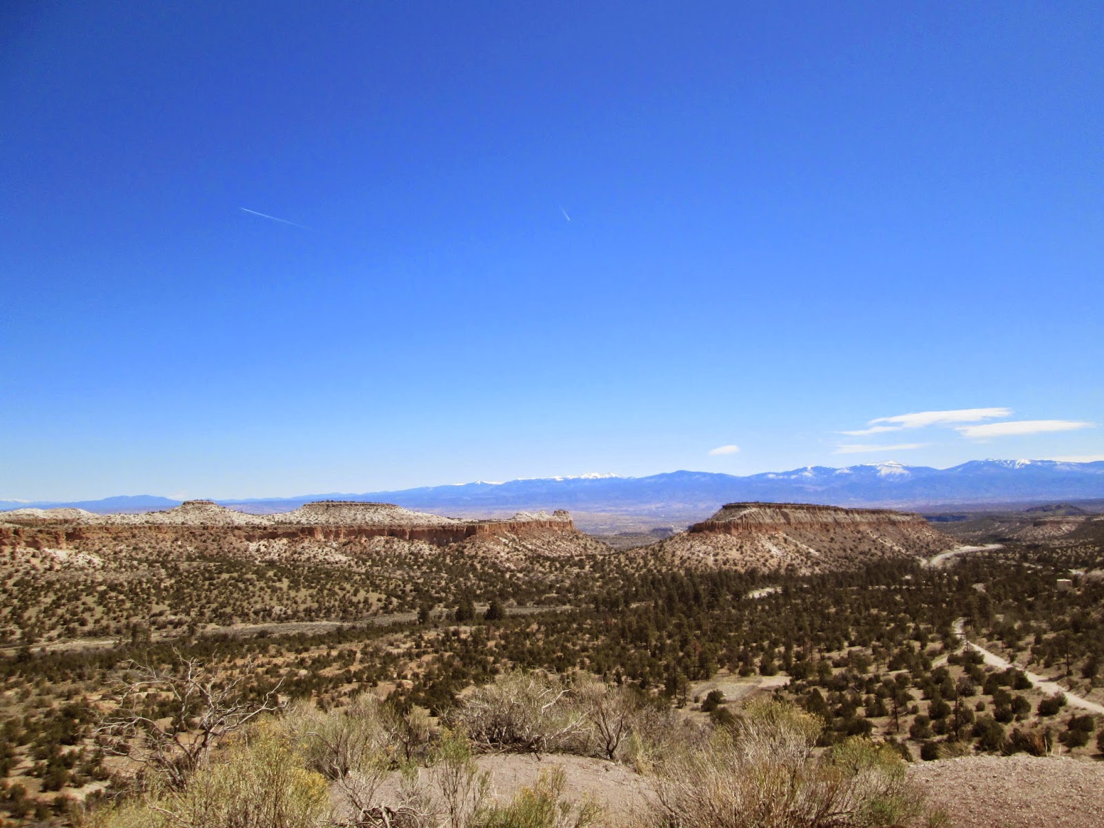
This is about 5 miles east of Los Alamos - check out the cool bluffs as I was riding down another 1k ft toward the Rio Grande.


And some more...


Local history


Mountains of the Sante Fe National Forest.


Found the Rio Grande (not that hard - just keep going down hill)


There are cliff dwellings back there - didn't have a chance to go check them out - next time...


Starting my long hike for the day up the Rio Grande.


Interesting history - along the Rio (yes, you guessed it) Grande


The river is starting to get quite small here.


Wide variety of rock formations.


Old Rusty stuff


Wow!


The water is starting to finally look really blue up here.


Local history.


I stopped here - Rio Grande gorge that I had been riding through the past 10 miles or so - very scenic, just like a small version of the Grand Canyon.


Zoom in on the picture.  This is just coming out of the gorge (1k ft climb) onto the plains that Taos is on.  To the far left is the Rio Grande, then Taos in the far distance on the plain and the snow capped mountains behind Taos - I think the one we can see here is Capulin Peak.


Nice view from the hotel tonight.


Wednesday, April 9, 2014

Day 14 (Wed, 9 Apr)

I’m back riding (finally…)! 

I rode from Albuquerque, NM to La Cueva, NM today.  A mountain ride heading generally north out of the Rio Grande River valley.  The ride was 73 miles with 3,500 ft of climbing starting at an elevation of about 5,000 ft and ending at about 8,000 ft.

Weather:  The weather was nice.  It was mostly sunny throughout the day with temps in the 40s in the morning climbing to about 70in the afternoon.  There was a mild 10 mph wind for much of the day that liked to rotate between head and tail winds during the day.

The Roads: I took Hwy 47 to get thru Albuquerque, then onto Hwy 528, Hwy 550 and finally Hwy 4 up the mountain.

Flat tire #2 (pinched/cut rear tube when I hit a rock).

Great riding day and the climbing on day 1 back on the bike definitely left my legs spent by the time I reached the summit…


On to the pictures!


Rio Grande


White sand dunes on the left side plateau.


Lots of red rock in this area!


I like everything about that sign...


Old Rusty Stuff.


Neat local, pueblo style church.


And more red rock.


Jemez is the main town in the area and many mountains in the region also use the name.


Yep, more red rock.


Heading towards those bluffs.


And the climb begins!


Awesome scenery and rock formations carved out by the small stream in the valley.


Still going up, and


more red rock


Cool rock formation (and good excuse to stop during the climb!)


Check out the explanation on the sign.


and then this really interesting natural dam.  That's a new one - never seen before.


Alright, starting to see pine trees again


I kept thinking during this ride that I'm going to need to get myself to the top of those bluffs - ughhh.


Amazing blue sky and high enough during the climb that you can definitively hear commercial jets going over at 30k ft - these 2 looked like they were in formation.


Getting close to the top - I hope!


Yep, there.


And made it to La Cueva (try to find that on your map!)